The train ride was great, although I didn't sleep too well in coach. I could have taken a sleeper car, but I didn't want to pay the extra $700! (For $700, I think I could have rented a Limousine to drive me from Fresno to Salem!)
The train didn't leave Fresno until 8:45 pm on Tuesday, so I had enough time to do some laundry, stop at the library to up-load some photos, go to FedEx Kinko's and print off some of my recent photos of the PCT, and get some snacks for the train ride to Salem.
The food on the train was really good, and it was fun to tell stories about my trek and to share some of my photos of Bullfrog Lake with other passengers.
The train was right on time getting to Salem at about 2:30 pm in the afternoon.
Thursday, June 26, 2008
Tuesday, June 24, 2008
Vermillion Valley Resort, PCT mile 877. I'll be taking several zero days as I make a quick trip home to Salem. I was able to get a round trip ticket on Amtrak, leaving Fresno today and returning to Fresno on July 6th.
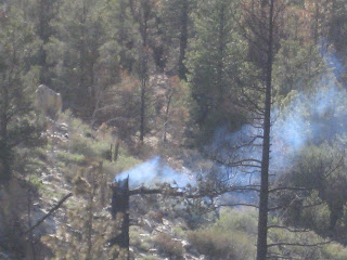
I will hitch back to Auberry, California from Fresno and get myself back to Vermillion Valley Resort. From there, I take the ferry back to the East end of Eddison Lake and get back where I got off the PCT at mile 877. Hopefully by then, some of the fires and all the smoke in the air will be out and I can continue on the trail.
I will hitch back to Auberry, California from Fresno and get myself back to Vermillion Valley Resort. From there, I take the ferry back to the East end of Eddison Lake and get back where I got off the PCT at mile 877. Hopefully by then, some of the fires and all the smoke in the air will be out and I can continue on the trail.
Monday, June 23, 2008
Bear Creek Crossing to Vermillion Valley Resort. 10 miles on the PCT, plus almost 2 miles on the side trail to Lake Eddison. 877 miles total on the PCT.
Tim, Louise and Julio were at the Ferry Dock on the East end of the lake, fishing and hanging out. They offered me a ride to the resort, and to stay the night in Auberry. The next day, Louise was planning a trip to Fresno, so I decided to get off the trail for a week to let some of the 900 forest fires (many of them ahead of me on the trail) to get under control. I also have some business back in Salem that I need to take care of, so I'll see if I can get a round trip train ticket to Salem and take a few zero days. It would be nice to spend the July 4th Holiday with my family.
We stopped for Pizza on the way back to Tim's place in Auberry. Then, Julio fried up the great trout that he had caught earlier in the day! It was very good! Tim had a trailer next to the house, so I slept very good!
Sunday, June 22, 2008
McClure Meadow Ranger Station to Bear Creek Crossing. 20 miles! 867 miles total.
Early in the day, the first of two major fords of streams: the Evolution Creek crossing. I crossed early in the day ... that was a good thing. Another hiker told me to not cross where the trail comes to the creek, but to go up-stream about 30 or 40 yards and cross there. It seems that there is a big hole right where the trail crosses, and you'll be in deep if you don't go up steam. The crossing went well, and it was only up the just past my knees.
The stream was fairly swift and diffentily cold! 5 hikers were camping on the other side, and they had a nice fire going. I sat and talked to them a bit while I was putting my dry socks and shoes back on.
The next pass to cross was Seldon Pass, one of the easier passes on this stretch of the trail. The bugs seem to be getting worse! I stopped in the afternoon and set up my tent and took a short nap, then ate an early dinner. Then, I packed it all up and continued to hike until almost 8:00 pm. I don't usually hike that late, but it allowed me to get in 20 miles today! I made it all the way to the next stream crossing, so do the crossing first thing in the morning.
I decided to make a campfire tonight. I don't usually have a campfire, but there was already a fire ring and there was a lot of available wood. It was nice to have a small fire.
Saturday, June 21, 2008
Bishop Pass Trail to McClure Meadow Ranger Station. 16 miles, 847 miles total.
I crossed the John Miur Pass today. It had a lot of snow, just like all the others. It was very difficult to follow the trail because of all the snow, and I ended up losing the trail several times. I had a general idea about which direction to go, but it is so much easier when you have a trail to follow. There are a lot of footprints, but sometimes, even the different footprints don't agree, so you have to decide which set to prints to follow.
There were so many streams and 'wet crossings' that I just kept my shoes on and got them wet! At one point, we were on the wrong side of the lake, so we had to cross the stream twice to get back on the trail. It was a good thing because had we stayed on the wrong side of the lake, we would have come to a cliff that wasn't passable, and would have had to hike all the way back to get across the stream again.
I think today had more water crossings that any previous day!
Friday, June 20, 2008
Base of Mather Pass to Bishop Pass Trail. 15 miles, 831 miles total.
I had planned to get over the pass before dark, but just as I got to the bottom of the pass at about 6:00 pm, my bear vault fell off my pack and landed on the ground near a bare spot (no snow!), and it wasn't too difficult to move a few rocks and make a soft area for my tent. It was like a sign saying "camp here tonight!"
I'm well above the tree line, and I think I'm at about 10,000 feet, so it's going to be cold night, but at least I'm not sleeping on snow.
Thursday, June 19, 2008
Twin Lakes to Base of Mather pass. 11 miles, 816 miles total.
I slept very good last night. The ground was soft from a decomposed log and some bark dust. Its cooler this morning because I'm camped at about 10,000 feet or so. I have to climb to 12,000 feet later this morning to get over the next pass. It should warm up once the sun comes out.
The weather continues to be outstanding ... clear sky and no rain at all! I had about 4 or 5 stream crossings today where I stopped and exchanged my hiking shoes for my sandals. Its really nice to be able to hike in dry shoes and dry socks. A lot of other hikers just hike right through the water in the shoes and let them dry out as they are hiking. I'm not a big fan of hiking in wet shoes with wet socks.
The bugs seem to be getting worse because there is so much water for them to breed in! There have been a few times when I wanted to stop for some fresh water, but when I see so many bugs, I just keep hiking.
The trail was beautiful today. I don't know that the pictures really show just how great this trail is. I think today might have been the most beautiful yet on the whole trail.
A hiker by the name of Flop hiked with me for part of the afternoon, and we decided to camp at the some spot tonight. Tomorrow's pass is in 7 miles, and there is a lot of climbing to do before we get to the top. I'm going to work on getting an early start!
Wednesday, June 18, 2008
Rae Lakes to Twin Lakes. 10 miles, 805 miles total.
I got a nice early start today, and stopped at the last of Rae Lakes to fix my breakfast. There are a few high clouds today, but mostly the sky is clear and bright blue.
I didn't see a lot of other hikers today. Most of the "herd" is past me now. There was a nice place to stop and fix a hot lunch ... still trying to get my food supply down enough to get it all in the bear vault!
I'm still about 72 miles from Vermillion Valley Resort, and I like this easy pace. The views are so beautiful the last couple of days ... I wouldn't want to be flying though this part. An since there are so many stream crossings and snow fields, its hard to do too many more miles than I'm doing anyway.
Tuesday, June 17, 2008
Near Pot Hole Lake to Rae Lakes. 6 miles, 795 miles total.


Today's challange is another tall pass: Glen Pass, at 12,000 feet.I didn't get to pass very early, so the snow was fairly soft, almost too soft. There was a lot of snow still, so it was slow going.
I stopped at the second lake on the other side of the pass, and even though I didn't travel very far, decided to stop early so I could cook a nice hot meal. There was a food storage box, and that was a good thing. I still can't get all my food in my bear vault! I'm trying to eat things that are bulky and heavy early in this stretch so I can force all my food into the bear vault!
There's another big pass tomorrow. In fact, there will be another pass to cross almost everyday day until I get to Vermillion Valley Resort.
Monday, June 16, 2008
Another zero day on the PCT anyway. Left Independence and started hiking back to the PCT on Kearsarge Pass Trail. I'm still at Mile 789 on the PCT.


After getting my box from the Post Office and sending a small box of unneccessary items home (I love to lighten my pack anytime I can!)
There were about 10 hikers trying to get back to the trailhead. Ted, a computer wizard from town, was shuttling people up to Onion Valley Campground, so at about 10:00 am, I was finally back on the trail. It was a steep climb up to the top of the pass, and with my very heavy pack, I was going very slow!
After a short while, Chris and Hatchet hiked by and shared some very important information with me. I saw them in Bishop on Sunday, and we split to cost of some fuel. Turns out that what they thought was alcohol turned out to be campstove fuel, or "white gas" ... not the same fuel at all. White gas burns much more quickly and had I not known, it might have even caused a small fire. I was lucky to talk with a section hiker that was hiking out to Onion Valley Campground, and his fuel bottle was almost empty (as it should be at the end of your journey!) He offered to take the fuel from my bottle, and I was glad to get rid of it. I'd rather have no fuel and eat my food cold than to have the wrong fuel and potentially cause a fire to start. If I'm lucky, I'll catch up with Chris tomorrow. He discovered that he had the wrong fuel before he left Bishop and had a new full bottle of alcohol that he said he's share with me if found a way to empty my bottle.
Sunday, June 15, 2008
Sunday, June 15, 2008 Father's Day
Zero day at Independence, and a side trip to Bishop. Mile 789 on the PCT.
The family in Independence that I stayed with was a very nice family, indeed. The father, Steve, is the manager at the Bishop Airport, and he offered me a ride to Bishop for the day. We made arrangements that if I still needed a ride back to Independence, he would look for me by the Golf Course as he drove back to Independence. If I wasn't standing along the side of the road, it meant that I had already found a ride. Sure enough, I was able to hitch a ride and got back to my tent at about 3:00 pm. or so.
I got a lot done in Bishop, and it was a very nice town. I did some shopping for a few extra items at Vons and another store called "Smart and Final". I think that I actually have too much food, but I have about a 9 day stretch until I reach Vermillion Valley Resort, where I have another box waiting for me.
I also saw a lot of other hikers both in Bishop and in Independence. I still have a box at the Post Office, but it won't be open until about 8:30 am tomorrow.
Saturday, June 14, 2008
Vidette Meadows to Bullfrog Lake Trail. 3 miles on the PCT, to mile 789. Then 9 miles to the Onion Valley Trail head and hitch a ride to Independence, California to pick up a box that I mailed here with food and supplies.
Without question, these are some of my best photos from the entire trip!


Also go to http://upix.biz/2008_06_14_Stephen_Fosdick/Aindex.html and look at photo 1876, 1882, 1883, 1892, 1895, 1897, 1905, 1906 and 1914.
I got a very early start this morning at 6:00 am. It was a good thing, too, because the lighting and colors at Bullfrog Lake were unbelievable. I took some very good shots showing the reflection of the mountains in the lake.
It was a big climb to get over Kearsarge Pass and down to Onion Valley Campground. There were a lot of hikers coming and going, but it was a great day on the trail.
On the way to the trailhead, there was a very nice couple that was hiking with their dog. They said that they would take me into town when they go, and they also invited me to join them and their 3 sons for some lunch. It was a very nice lunch, too!
When I got to parking lot, Steve was waiting for his son Eddie to do some fishing in a pond near the campground. He said that he would be going into Independence soon, and that I was welcome to ride with them. It was nice that the other family didn't have to make a special trip just for me. I ended up camping in Steve and Eddie's yard, and they even invited me to enjoy some of the trout that they had caught earlier that day. It was a great evening, and I really enjoyed getting to know them and staying with them.
Without question, these are some of my best photos from the entire trip!
Also go to http://upix.biz/2008_06_14_Stephen_Fosdick/Aindex.html and look at photo 1876, 1882, 1883, 1892, 1895, 1897, 1905, 1906 and 1914.
I got a very early start this morning at 6:00 am. It was a good thing, too, because the lighting and colors at Bullfrog Lake were unbelievable. I took some very good shots showing the reflection of the mountains in the lake.
It was a big climb to get over Kearsarge Pass and down to Onion Valley Campground. There were a lot of hikers coming and going, but it was a great day on the trail.
On the way to the trailhead, there was a very nice couple that was hiking with their dog. They said that they would take me into town when they go, and they also invited me to join them and their 3 sons for some lunch. It was a very nice lunch, too!
When I got to parking lot, Steve was waiting for his son Eddie to do some fishing in a pond near the campground. He said that he would be going into Independence soon, and that I was welcome to ride with them. It was nice that the other family didn't have to make a special trip just for me. I ended up camping in Steve and Eddie's yard, and they even invited me to enjoy some of the trout that they had caught earlier that day. It was a great evening, and I really enjoyed getting to know them and staying with them.
Friday, June 13, 2008
Bottom of Forrester Pass to Vidette Meadow. 7 miles, 786 miles total.


There are so many shots everyday, that it is very hard to narrow down which photos to share. Check out images 1790, 1794, 1802, 1816, 1818, 1830, 1835, 1841, 1844, and 1861 at http://upix.biz/2008_06_14_Stephen_Fosdick/Aindex.html.
I'm not sure it was such a good idea to try the most difficult part of this trail (to date) on Friday the 13th! It was without question the most difficult thing I've ever done in my entire life! But, oh, what an exciting adventure it was.
Yesterday in the late afternoon, I watched three hikers start the climb at about 3:00 p.m. I knew that if I started then, I'd get stuck somewhere on the pass and have to camp overnight in the middle, so I stayed in a clearing at the base, and now I'm really glad that I did, because the three hikers all took the wrong path, and ended up crossing too high. The actual trail, that you can't see until you are about 1/2 way up a big pile of rocks, was to the left about 500 yards or so. Once you found the trail, it wasn't too difficult to follow, even with the snow patches. There were more switchbacks than anywhere else on the trail!
Once on the other side, you had to deal with a lot of snow, but about 5 other hikers had passed me on the way up, and they were waiting at the top ... resting and enjoying the view! I hope I can post some of the photos soon because they are totally exciting.
You can view all of the photos at http://upix.biz/2008_06_14_Stephen_Fosdick/Aindex.html. When I get to a computer that has a faster connection than dial-up, I'll post some of the better photos. Keep checking back.
Thursday, June 12, 2008
Wallace Creek to the bottom of Forrester Pass. 9 miles, 779 miles total.


I'm camped on a big flat just below the start of the final approach to Forrester Pass, a 13,000 foot pass a little ways beyond the trail to Mt. Whitney. I'll get up late tomorrow and tackle Forrester Pass.
Also see images 1729, 1744, 1747, 1753, 1764, 1777, 1780 and 1784 at http://upix.biz/2008_06_14_Stephen_Fosdick/Aindex.html.
Wednesday, June 11, 2008
Rock Creek Crossing to Wallace Creek. 10 miles, 770 miles total.


Also see images 1689, 1693 and 1711 at http://upix.biz/2008_06_14_Stephen_Fosdick/Aindex.html.
Also see images 1689, 1693 and 1711 at http://upix.biz/2008_06_14_Stephen_Fosdick/Aindex.html.
Tuesday, June 10, 2008
Trail Pass Trail to Rock Creek Crossing. 16 miles, 760 miles total.


There are some more really good photos for today. Visit http://upix.biz/2008_06_14_Stephen_Fosdick/Aindex.html and view photos 1583, 1592, 1608, 1609, 1622 and 1636.
If you 'right click' on a thumbnail at the link above, then click on 'properties', burried in the address will be a 4 digit number that correspondes to the numbers I've listed here. Also, as you scroll over the thumbnails, you will see the image number down at the bottom of your screen. When you find the right image, click on the thumbnail and it will open in larger view.
Monday, June 9, 2008
A year round creek to Trail Pass Trail. 16 miles, 744 miles total.


I'm making better mileage in the Sierra Mountains that I thought I would.
I'm making better mileage in the Sierra Mountains that I thought I would.


Friday, June 6, 2008
Thursday, June 5, 2008
Fox Mill Springs to Kennedy Meadows. 19 miles, 702 miles total!


I got an early start today. I needed to get started early because it was 19 miles to Kennedy Meadows.
There were some great views of the South Fork of the Kern River, and I honestly thought about camping there, but the draw to get to Kennedy Meadows and the store was strong, so I pressed on. I made it to the store at 5:00. There are at least 20 hikers staying here. I have some boxes waiting for me, but I think I'll wait until tomorrow to get them.
I'm planning on taking a zero day tomorrow, just to rest a bit.
Wednesday, June 4, 2008
Spanish Needle Creek to Fox Mill Spring. 16 miles, 684 miles total.

I hike with Land Shark and Catepiller today. It's been nice to see them again.
The day was cold and windy in the morning, but it soon came to sunshine and warmed up nicely.
Water was not an issue today, either. There was plenty, and it was good water. This is what it will be like in the Sierra Mountains, and I won't need to carry the 4 liters of water that I've been carrying. That will save on weight and will allow me to carry more food.
I had a big hill to climb today ... from 5,500 feet to 8,000 feet! I decided to camp about 1/2 the way up, just to save part of the climb for tomorrow. I ate an early dinner, and my tent is all set up and ready for sleeping.
Tuesday, June 3, 2008
Owen's Peak to Spanish Needle Creek. 8 miles. 668 miles total.


I'm really taking my time in this section, as I don't want to get to Kennedy Meadows too early and I'm really liking it here. It's nice to be out of the desert and I really like the trees and the stream.
I got a late start at 9:15 am, but who cares! It quickly got warm, so I took a lot of shade breaks.
Several hikers stopped by my camp late in the day ... boomer, Gater, Pickles, Moondog, Ant Farm and Swiffer, Stabby, Jelly Bean, JB, and Moon Pie! I enjoyed talking with them. Most of them hiked on another mile or two to the second creek crossing.
Monday, June 2, 2008
Near Onyx to Owen's Peak. 8 miles, 660 miles total.
When I woke up, I got everything packed and walked down to the road. I had no idea if I was going to have any easier time hitch-hiking today or not. I start walking to a pull out about 50 yards ahead of me, and before I could get there, the second car to pass me pulled over and offered me a ride. I hadn't even started to hitch-hike yet! Not at all like last night!
Back at the campground, Meadow Mary was there with water and fruit! It was a great treat. There were other hikers there, too. Some were heading into town, and others were going back out on the trail. I decided to spend the day resting, but by about 1:30 pm, I couldn't just sit there any longer and decided to start hiking down the trail. I was taking it slow, and that was OK. I'm not in any big hurry to get to Kennedy Meadows because I'm ahead of schedule (what is a schedule?) for leaving Kennedy Meadows. I originally planned to leave KM on about June 15th or so.
Here's the big news! Someone hiking on the trail past the ledge I had camped at found my lost tent stake and brought it to Walker Pass Camp Ground. I was so surprised to get my tent stake back!
Owen's Peak had a great place to camp, and even though it had been windy earlier in the day, the wind seemed to calm down a bit, and I slept really good.
Sunday, June 1, 2008
Bird Spring Pass to Walker Pass. 18 miles, 652 miles total.
From Walker Pass, you can hitch a ride to Onyx or to Lake Isabella. I decided to try to make it to Lake Isabella for Pizza. I was hitching with Outback and Pippi. It seemed to take forever to get a ride in the early afternoon, but really it only took about 45 minutes. The first ride in a nice truck had some weekend backpackers, but they didn't take us the whole way.
The next ride didn't take as long ... maybe 10 minutes, and he took us all the way to the Pizza Factory / Right Aid / Von's. My first stop was the Pizza Factory, and the pizza was very good!
Next I went to Right Aid, and was able to download my photos to CD's. That's always a good thing. Then I went to Von's to round out my food purchases. My pack is very heavy, but at least I won't be going hungry out on the trail.
It was about 6:00 pm, and I really didn't want to stay at the motel in town, so I decided to get a quick milkshake from Burger King and hitch back to Walker Pass Camp Ground. It didn't take too long to get a ride, but they were only going as far as Onyx. They dropped me at the gas station, and even though it was starting to get dusk, there was a lot of traffic, and I didn't think it would take too long to get a ride the 9 miles to the campground. WRONG! At least 50 cars past by, and not one of them would stop. After it was dark, I was standing the light of the gas station, and I had my headlamp on flashing mode, so I know that people could see me, but no one was willing to take a chance on picking up a hitch-hiker at night.
I ended up walking about 2 miles up the road and camping about 30 yards from the road on a bluff. I didn't sleep too go because there was traffic during the night.
Saturday, May 31, 2008
SNF Road 29SO5 to Bird Spring Pass. 25 miles, 634 miles total.
I got an early start today. That was good. Scout and Frodo were serving breakfast at Mile 618

There were a lot of hikers there ... maybe as many as 30. French Toast was being served for breakfast, and they were getting ready to serve pasta for lunch! It was a great treat in the middle of the hot desert hike! This section of the trail had very little shade.
I ended up camping on a 20' wide ledge of a cliff, near a big rock that made a very nice place to cook with my stove. It was windy earlier, but the wind was much calmer when I set up my tent. However, in the night, there was a big gust of wind that caught my tent flap and shot my tent stake into the air like a slingshot! I could hear it hitting rocks, but I could not find it in the morning. This might be a problem unless I can find another tent stake because I only have two of them with me, and I need both of them to keep my tent in place. I even had a large rock on top of it, like I normally do, but it shot out anyway!
Friday, May 30, 2008
Robin Bird Spring to SNF Road 29SO5. 14 miles, 609 miles total.
It was warm again today. I saw a lot of new hikers today. It seems that what they call "the herd" is starting to catch up and pass me. These are hikers that started the PCT at the kick-off. I started hiking about 2 weeks before the kick-off, so these are much faster hikers than me.
It's OK though. Once I get to the Sierra Mountains, I'll be glad to have lots of foot prints to follow in the snow.
Thursday, May 29, 2008
Golden Oaks Springs to Robin Bird Springs. 14 miles, 595 miles total.
I was camped just a little before Robin Bird Springs. The springs was nice, and there were a lot of people there getting water. When I was already to leave, I couldn't find my hat! I decided to hike back to where I camped (about a mile), just to see if I could find it. No Luck!
Back at the Spring, I checked the area where I sat to fill up my water bottles, and sure enough, there it was. I was so glad to find it, as the sun gets hot and without a hat, it can get really hot!
Tuesday, May 27, 2008
Willow Springs Rd. to Highway 58. 8 miles, 566 miles total.
Megan took me to the school where Chase, Blake and Lindsay, then she dropped me at Albertson's after a quick stop at Starbuck's. I bought enough food to prepare 3 food boxes and stopped at a postal place and mailed them ahead. There are a few places up the trail that don't have a lot of selection when it comes to re-supply.
I had such a good time staying in Techachapi, and it was pure trail magic, as they say. The Indiana Jones movie was fun and I enjoyed it.
It was about noon when I made it back to the trail. Had to hitch 3 rides to get back to where I got off the trail, and I so I only mad it about 8 miles for the day.
Subscribe to:
Posts (Atom)